
Search Maplewood Streets by Address
Start with one complete address, not a surname. Maplewood systems do not share one master address number. The municipal tax and permit routes, county land index, state parcel tools, postal lookup, and historic directory scans each use their own key. Normalize the house number, direction, street suffix, and unit first. Then confirm that the municipality is Maplewood before carrying the result into a parcel or deed search. This order prevents a mailing address, a postal label, or an old street entry from being mistaken for the property itself.
- Check the exact delivery format with the USPS ZIP Code Lookup, including any unit and ZIP+4 returned for the address.
- Use the state Property Explorer or the NJGIN parcel resource to record municipality, block, lot, parcel context, and the source date.
- Check the Township’s assessor, tax, and permit routes for a property card or permit history tied to that address.
- Run the block and lot through the Essex Register’s PRESS index in bounded date windows when an ownership transfer is the question.
- For an earlier household, compare the address with a dated Maplewood directory street page rather than treating a current property result as an occupancy list.
A property owner, taxpayer, permit applicant, and directory listing can all differ. The sequence keeps those roles separate while building a usable Maplewood street directory trail.
Normalize a Maplewood Street Address
Save the address in the form each custodian uses. USPS supplies the standardized delivery address, postal city, five-digit ZIP, and ZIP+4. Parcel and tax sources add municipality, county, block, lot, and sometimes a parcel PIN. The assessor distinguishes a situs address, the physical property address, from a mailing address used for notices. A mismatch is not automatically an error. It can reflect a condominium unit, a recent transfer, an entity owner, a different mailing destination, or an address format change.
Keep a source date beside every field. The state notes that annual assessments are made locally and sent to the county Board of Taxation, so a January list may not reflect a transfer made later. The Township’s tax and sewer search information also uses separate tax-account and sewer-account keys. Those accounts are not interchangeable, and neither alone identifies a current household.
Note: Preserve unit and suffix details until an exact-address search has failed, because dropping them too soon can join the wrong record.
Maplewood Parcel Keys by Street
The Maplewood Tax Assessor maintains the ratable base, property records, tax maps, added assessments, tax appeals, and deed-related materials. Property Explorer shows location, county, municipality, block, lot, owner when displayed, annual assessed land and building values, prior-year taxes, and classification. NJGIN supplies parcel geography and PIN context. Taken together, those sources provide an address-to-parcel bridge for a Maplewood street search.
| Field | How It Helps | Limit to Keep |
|---|---|---|
| Address or location | Locates the property record | Formatting can differ from postal delivery form |
| Municipality, block, and lot | Connects the parcel to PRESS | Use the legal-record key, not a name guess |
| Owner display | Identifies a recorded assessment role when shown | It may be stale, an entity, or lawfully redacted |
| Assessment and classification | Gives annual property context | It is not a sale price or occupancy statement |
| Parcel polygon or PIN | Provides map context | A polygon is not a legal survey or boundary |
Use the municipal assessor by appointment or the county Tax Board when a portal lacks the needed property-card detail. A written Maplewood OPRA request should name an existing property, permit, tax, or zoning record and its custodian. OPRA does not require staff to assemble a new street list.
Maplewood PRESS Deed Paths
The Essex Register’s PRESS basic search is the street directory tool for recorded instruments, not for daily residence. By Block and Lot requires municipality, block, lot, and a date range. Maplewood is one of the municipality choices. By Name accepts a last or company name, an optional first name, plus optional document and date filters. Document Type offers a municipality, document type, and From and To dates. Its date windows are capped at 90 days, so a long ownership trail needs consecutive searches with each interval recorded.
The Register distinguishes index coverage from remote image access. PRESS describes a transaction index from October 1, 1996 onward, while Register guidance describes remote public-vault transactions from May 1, 2001 to the present and older public-vault material. Some mortgage cancellations before July 2, 2012 can be indexed without an electronic image. A result, an available image, a book and page reference, and an in-person title examination are different outputs.
The PRESS search screen shows its separate Instrument, Document Type, Block and Lot, and Name modes.
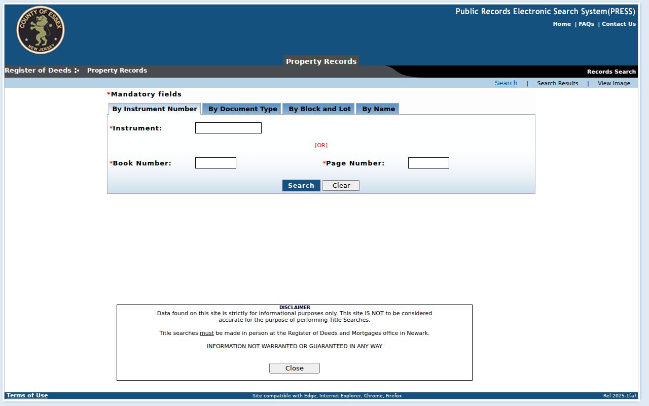
Use the block-and-lot route for a parcel chain, then contact the Register or inspect at the counter when the index does not supply the needed image or title-level answer.
Note: Write down each 90-day PRESS interval, search mode, and result count so an apparent gap can be checked again later.
Maplewood Permit History by Address
A permit history is a useful address clue because the Township’s OPRA materials name the GovPilot permit map, certificates of occupancy, property cards, zoning, utilities, and permit/property records as record categories. The map can point to a record tied to a site. It does not turn plans or protected material into public downloads, and a permit may identify an owner, contractor, or agent rather than a resident.
When the map does not expose the needed record, use the Township custodian, phone, mail, or a specific OPRA request. State the address, record series, and approximate date. A request for an existing permit or certificate is more precise than asking for everything connected with a street. Retain the source response and any redaction note with the address record.
Read Maplewood Street Maps Carefully
NJGIN’s parcel layer is valuable for street context, parcel geometry, and stewardship information. It also carries a crucial warning: parcel polygons are not legal boundaries or surveys, and parcel edges may not align cleanly. The Maplewood street directory should therefore use a map to locate a parcel and its nearby street pattern, not to settle a legal line or claim a precise resident boundary.
The official NJGIN parcel page explains the parcel-data setting and its map limits.
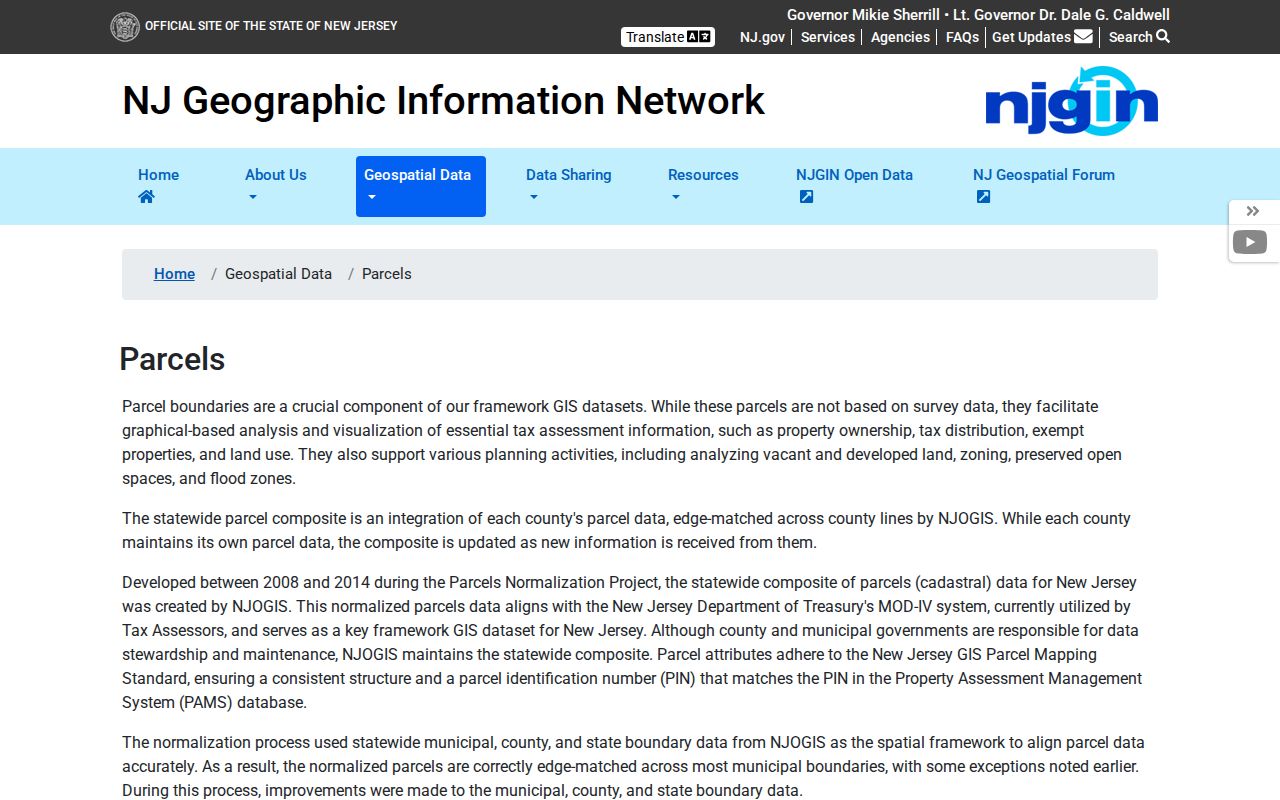
For a legal boundary question, rely on the recorded lot, plan, or survey instead. The municipal map, parcel viewer, and historic maps each describe a different layer of the street.
Note: Pair a map date with the block and lot, since a parcel view without its date can hide later changes.
Dated Maplewood Street Listings
Maplewood Memorial Library’s digitized directory collection supplies a historical street-level layer. It contains 34 editions from 1888 through 1970. The 1959 street guide gives a concrete example: its Briarcliff Court entry describes the street from 175 Parker Avenue northeast to a dead end, then lists numbered entries. Tower Drive includes numbered addresses, apartment notation, and a vacant entry. These details can help reconcile an old street order with other dated records.
The entry is evidence from the printed year and scanned page, not proof of present occupancy. Save the publication year, page, and printed street heading. The library’s digital City Directory collection is the access route for those scans, while the Maplewood city directories section handles the full historical collection and its reading conventions.
Maplewood Street Record Coverage
Address-keyed sources are most useful when the result remains attached to its record type. The coverage below separates ownership, delivery, permit, map, and historical listing evidence. A deed records a transfer. A parcel map gives geographic context. A directory entry places a listing in a dated publication. None should be silently converted into a claim about who currently lives at an address.
| Address Record | Maplewood or Essex Keeper | Street Result | Access Route |
|---|---|---|---|
| Property and tax record | Maplewood Tax Assessor | Assessment, location, block and lot, owner display when available | Assessor, tax route, or specific OPRA request |
| Parcel map | NJGIN and Property Explorer | Parcel context, PIN, municipality, and map geometry | State web resources |
| Recorded instrument | Essex Register of Deeds and Mortgages | Deed, mortgage, lien, and related recorded-index trail | PRESS, Register counter, phone, or email |
| Permit or property file | Maplewood custodian | Address-tied permit or property record when releasable | GovPilot, custodian, or OPRA |
| Historic street listing | Maplewood Memorial Library archive | Names and address sequence in a dated edition | Digital scan, library staff, or local-history access |
The Register’s Hall of Records counter and the library’s staff and local-history access are important fallbacks when an online record is incomplete. The county Register, not the County Clerk, handles deeds, mortgages, and liens.
Note: Keep the keeper and access route with every Maplewood street result, because an index and a custodian copy have different evidentiary value.
Maplewood Street Record Terms
Several labels recur in a street search. Reading them consistently makes it easier to compare tax, map, deed, and directory sources without treating similar-looking fields as the same fact.
- Parcel
- A mapped unit of property used in assessment and GIS systems; its polygon is map context, not a legal survey.
- Situs address
- The physical property address, which can differ from the owner’s mailing address.
- Plat
- A recorded map or plan that depicts lots or subdivisions; it carries more legal weight than a viewer polygon.
- Criss-cross directory
- An address-organized directory section used to find listings by street and number in a particular publication year.
The full street record often needs more than one of these keys. A postal address gets the search started; a block and lot makes the recorded-property search more precise.
Maplewood Postal and Situs Fields
USPS and local government answer different address questions. USPS says its ZIP lookup returns a delivery ZIP and warns that the result does not establish that a person or company is at the address. The municipal assessor and parcel sources identify civic geography and property keys. Keep postal city, municipality, county, ZIP, ZIP+4, block, lot, parcel PIN, mailing address, and situs address in separate fields.
Maplewood’s official USPS sources identify 07040 as the primary five-digit postal ZIP found for Maplewood. Nearby Millburn uses 07041 in the USPS facility source, so it should not be relabeled as Maplewood. An exact address lookup is the safe way to resolve a delivery question.
Maplewood Street Privacy Stops
A blank or missing field can be a lawful protection, not a failed search. Daniel’s Law can suppress covered public servants’ home addresses and related information in government web records. New Jersey’s Address Confidentiality Program uses substitute-address and mail-forwarding protections for eligible participants. Voter, motor-vehicle, vital, court, and OPRA rules also protect different kinds of personal information.
For a protected record, follow the named program or custodian rather than joining fields from several sources to fill the gap. The Daniel’s Law Office of Information Privacy and the Address Confidentiality Program explain their distinct protections.
Maplewood Street History Gaps
No official Maplewood street-renumbering or alias chronology was located in the research. That gap matters when an old directory number does not line up with a current map. Search the historical street name and common suffix form, keep the block and lot as the stronger property key, and compare a dated directory, recorded instrument, and map or plan before drawing a conclusion.
The 2025 Historic Preservation Element names areas such as Roosevelt Park, College Hill, Boyden/Burnet, Golf Island, Valley Street, South Mountain Reservation, and Maplewood Station. Those labels can provide street-history context, but they do not establish a parcel designation or fill a missing address history.